Sponsored Links
Arizonensis --> Sonoran Desert Naturalist --> Sonoran Desert Places --> Hieroglyphic Mountains
|
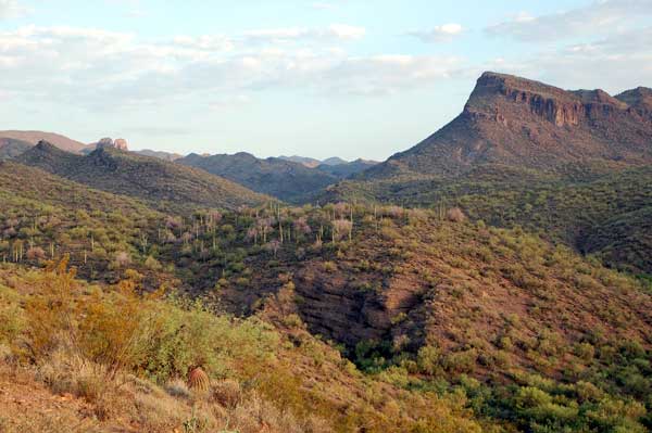
The Hieroglyphic Mountains straddle the Yavapai-Maricopa county line in an area west of Lake Pleasant and north of Peoria. The northern portions are particularly rugged having been formed from Mesozoic rhyolite and tuff that is cut deeply by canyons. Garfias Wash cuts west to east with its western, higher elevation sections within the wilderness. Castle Hot Springs Wash loops around the north edge of the range and offers the best access. Castle Hot Springs itself is a private property without public access. Castle Hot Springs is thought to be one of only two localities in Arizona where California Fan Palm -- Washingtonia filifera, grew naturally. From Phoenix, drive west on the Carefree Hwy. from I-17. Turn north on the Lake Pleasant Road, about 3 miles past the Agua Fria bridge. Drive past the Lake Pleasant entry gates onto Castle Hot Springs Road which soon turns to wash boarded gravel and some areas of sand. Passenger cars should be used with caution. About 3 miles past the Castle Creek Bridge there is a cattle guard. Immediately after the guard is a BLM trail sign. The trail registry is directly across the broad wash: Castel Creek Trailhead. This trailhead is also just about 1 mile past the Casa Rosa Ranch. |
View Larger Map. Reach the east end trailhead (hiker icon on right) via Castel Hot Springs Road via Lake Pleasant (tent icon). |

|
This photo of a Variegated Fritillary was taken by Laurie Nessel. |
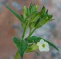
Nov. 17, 2002From the Castel Creek trailhead I first hiked south across the broad wash. Here the sand is deep and the vegetation dominated by Burro Brush, Canyon Ragweed, Desert Hackberry and Desert Tobacco. On the south bank I found a narrow bosque of mesquite trees, the trail registry, and a sign designating the wilderness boundary. A moderate climb sent me past some colorful rhylolite cliffs on my left, then across a flat area. I was disappointed to see a telephone pole and wires stretching through the wilderness and the roar of ORV's in the east hit my ears. At 1.5 km there is a small water-filled tank. The wild burros have been taking water here as evidenced by fresh dung. The trail terminates at Garfias Wash but the hiker could walk up this wash to the west for a considerable distance. There was a good diversity of shrubs and quite a few wildflowers were in bloom. I spotted two butterflies on the wing: Variegated Fritillary (Euptoieta claudia) and Sleepy Sulfur. Cat Claw Acacia had an abundance of burgundy-colored leaf galls. The warm weather may have been why I spotted a Rock Squirrel out so late in the year. |
BirdsIn general order of Abundance:
|
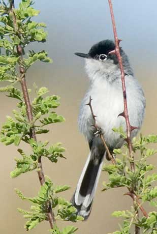
Photograph is copyrighted by Robert Shantz at Lower Steeple Rock Canyon, Hidalgo County, New Mexico. This male has a distinctly black cap. Females lack the cap, and during the winter months the male's cap fades away. |
MammalsThe odor and naying of Wild Burros are evident throughout this area.
|
|
Common species at top of list:
|
|
Shrubs and TreesCommon species towards top of the list.
|
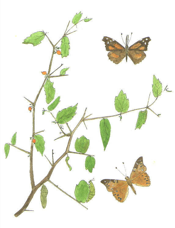 Celtis pallida with the Snout Butterfly (top) and Hackberry Butterfly Turpentine Bush |
Sonoran Desert Naturalist
Home Page
Desert Places
Field Guide